







The Venetian landscape is the result of centuries of interaction between people, water, and nature, as documented by historical maps.
Listen to the audio
Observing today’s landscape means reading the traces left over the centuries by the relationship between nature and humans. Rivers, woods, fields, and inhabited areas are not random elements: they tell a long history of transformations that have shaped the land and the lives of communities.
The ancient maps displayed in this section allow visitors to discover how three fundamental protagonists of the Venetian landscape were distributed: water, vegetation, and humans. Depending on the goals of those who created them, each representation highlights one of these elements, offering a precious glimpse into the territory of the past.
For centuries, Venice was the primary political and economic hub of the area. Safeguarding the lagoon was an absolute priority, as the commerce and prosperity of the Serenissima depended on it. For this reason, interventions were made on rivers through diversions, channels, and hydraulic works designed to control the flow of water and limit the accumulation of sediment in the lagoon.
The woods also played a strategic role. In addition to helping protect the land, they provided the timber necessary for the Venetian Arsenal. Historical maps bear witness to a forest presence that was far more extensive than it is today, with wooded areas spreading along the lagoon belt, on the Montello, in Praglia, and in many other locations.
Human settlements were concentrated primarily near waterways. Although rivers posed a significant risk due to frequent flooding, they were also vital communication routes and indispensable resources for economic activities.
It was from this often complex and conflictual relationship between humans and water that the great land reclamation works and profound transformations were born, ultimately shaping the Venetian landscape we know today.
Listen to the audio
This cartographic journey shows the evolution of how land was represented over the centuries. Early maps, created through direct observation and often stylized drawings, gradually gave way to increasingly precise and scientific documents.
Over time, the introduction of new measuring instruments and the application of mathematical methods made it possible to produce more accurate maps. These became essential for designing hydraulic works and managing the land. Despite their technical differences, both the oldest and the most modern maps retain enormous informational value.
The earliest representations primarily highlight the network of waterways and the numerous human interventions made to modify it. Through these maps, one can identify both large and small-scale projects—the results of individual or collective initiatives—even if the outcomes were not always what had been hoped for.
In the 18th century, attention toward environmental and territorial issues grew. Administrators, scholars, and engineers engaged in intense debates to understand the causes of land degradation and to find effective solutions for water management. This gave rise to innovative projects that, in many ways, anticipated a modern ecological sensitivity.
However, not all of these plans were successfully realized: political interests and private initiatives frequently hindered their implementation.
While knowledge of the land became increasingly thorough and scientific—as demonstrated by major cartographic works like the Rizzi-Zannoni map—the political and social organization still struggled to transform this knowledge into concrete, shared interventions.
Listen to the audio
Open the high quality map (6.6 Mb)
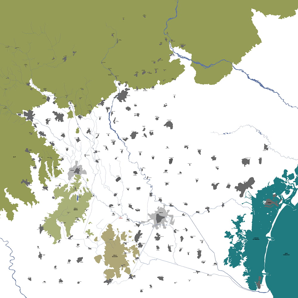
The Bacchiglione is not just a single waterway, but the result of a complex system of rivers, torrents, and canals extending from the Prealps all the way to the Venetian lagoon.
In the mountainous section and the upper plain, the streams have a torrential character, fed by alpine valleys and karst areas. Further south, in the resurgence zone, the system becomes more regular and gives rise to the Bacchiglione we know today, enriched by the waters of the Tesina and Retrone rivers.
Over the centuries, the river has been an essential resource for local communities: it facilitated travel, supported production activities, and provided energy for mills and hydraulic plants. For this reason, its course was frequently modified through canals, diversions, and regulation works.
Downstream from Padua, the Bacchiglione enters a dense network of artificial canals designed for navigation and flood protection. The map tells the story of this long relationship between humans and water, showing how today’s landscape is the result of centuries of transformation.
Listen to the audio
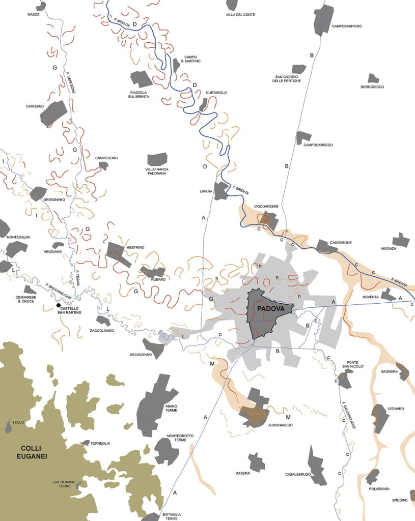
Open the high quality map (4 Mb)
Rivers continuously change their course. Over time, they carve out new bends, abandon old channels, and reshape the land, leaving marks that can still be recognized today.
This reconstruction shows the traces left by the ancient courses of the Brenta and Bacchiglione rivers in the Paduan plain. Some of these shapes are still visible in the landscape, while others emerge thanks to the study of the soil and aerial photographs.
Particuly evident is the imprint left by the ancient Brenta, which in the past followed different paths from its current ones. Its floods deposited sand and sediment along the banks, creating slight elevations that influenced both the evolution of the rivers and the distribution of human settlements.
By observing the map, it is possible to understand how the land has never been static, but is rather the result of a continuous interaction between natural phenomena and human intervention.
Listen to the audio
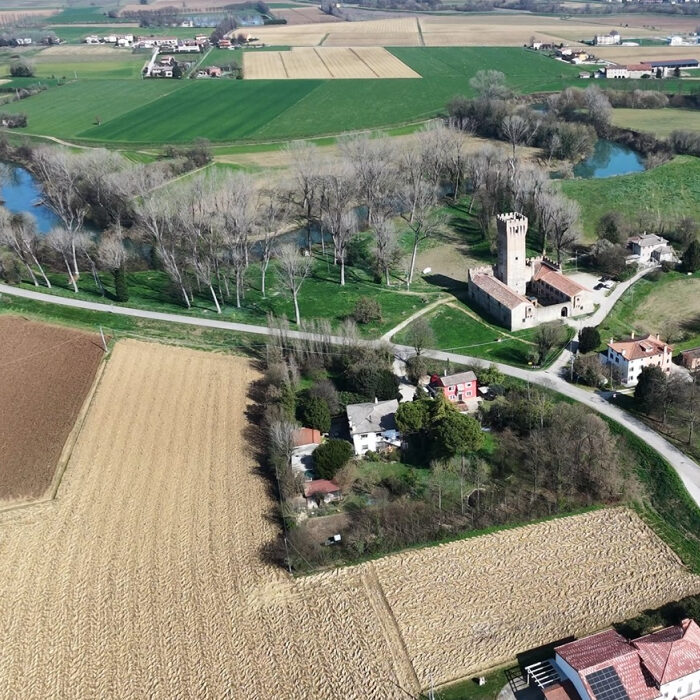
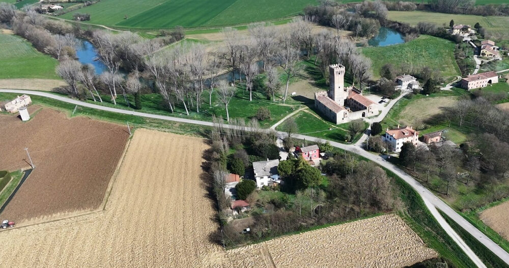
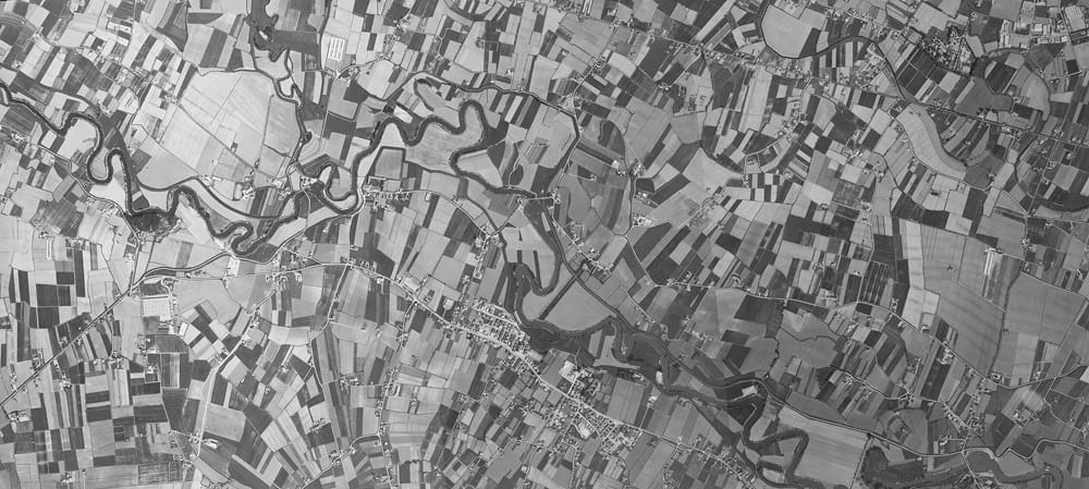
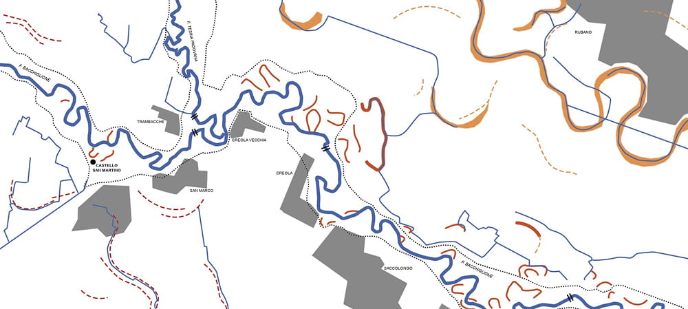
Aerial photographs represent a valuable tool for understanding the history of the land. By observing the landscape from above, it is possible to recognize details that often escape notice at ground level: landforms, ancient river courses, and marks left by the interaction between water and human activities.
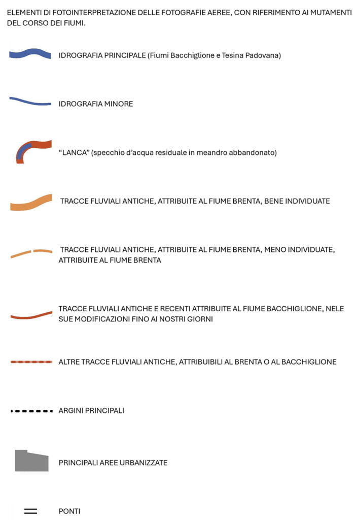
The photograph presented here was used as a base to create an interpretive map that highlights some of the most significant elements legible in the landscape. Comparing the two images reveals how the observation and analysis of the territory can be transformed into a tool for reconstructing its evolution over time.
Legend
Discover the archaeological collection from the Bacchiglione River
Cookie policy
Su questo sito utilizziamo strumenti propri o di terze parti che memorizzano piccoli file (cookie) sul tuo dispositivo. I cookie sono normalmente utilizzati per consentire il corretto funzionamento del sito (cookie tecnici), per generare rapporti sull’uso della navigazione (cookie statistici) e per pubblicizzare in modo adeguato i nostri servizi/prodotti (cookie di profilazione). Possiamo utilizzare direttamente i cookie tecnici, ma hai il diritto di scegliere se abilitare o meno i cookie statistici e di profilazione. Abilitando questi cookie, ci aiuti a offrirti un’esperienza migliore.